
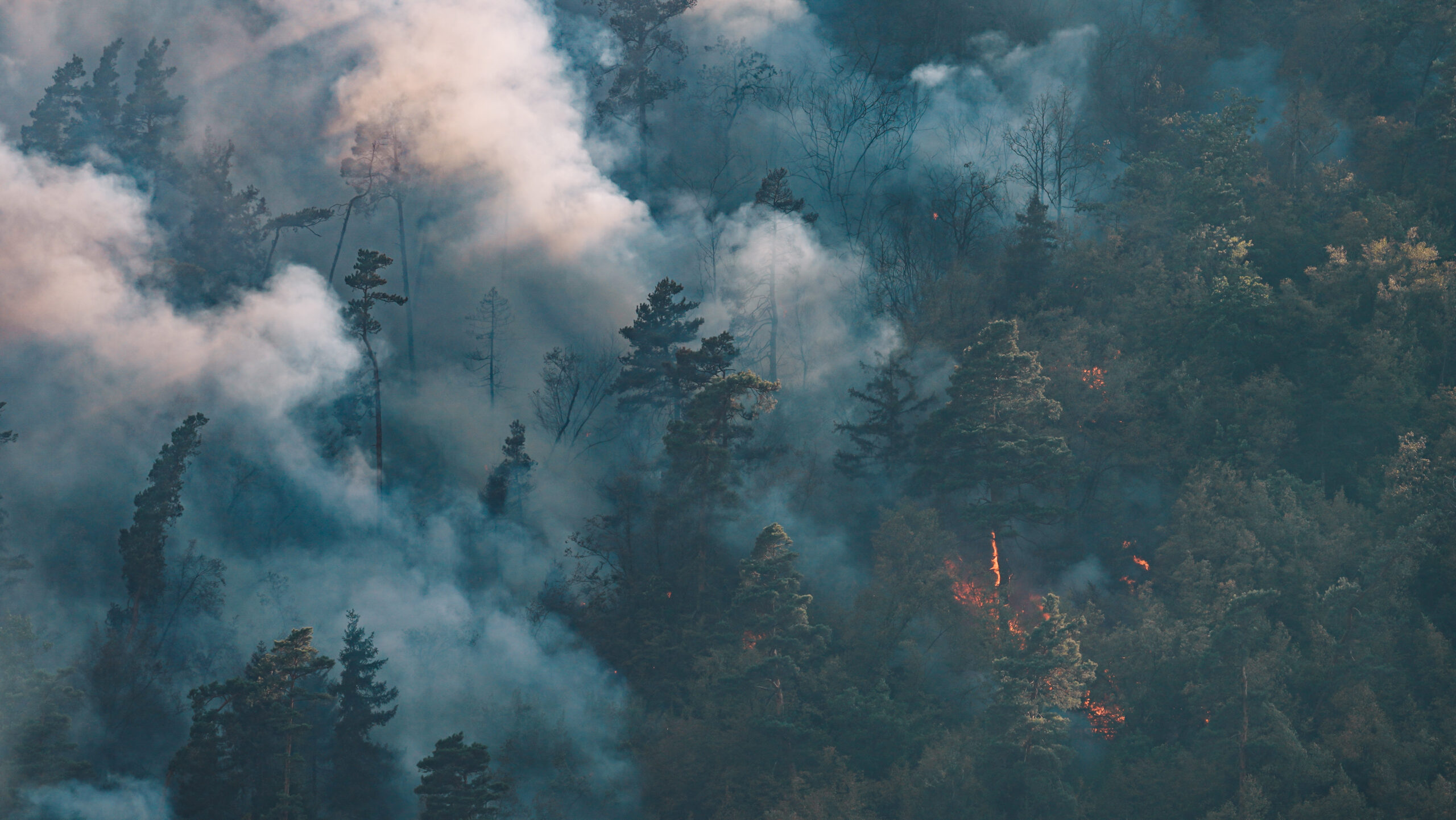
On April 15, 2025, a wildfire broke out on Bardon Hill near Coalville, Leicestershire, sending thick smoke into the sky and charring a large section of this historic landscape. Though the blaze was brought under control by Leicestershire Fire and Rescue Service, its aftermath left a visible scar on the region.
At AeroBlueprint Imaging, we arrived after the fire was extinguished to capture the aftermath using our drones. Our aerial footage documents the damage from above, offering a rare and compelling look at the impact on the land and environment.
Watch the full video below:
The Significance of Bardon Hill
Bardon Hill is the highest natural point in Leicestershire and part of a Site of Special Scientific Interest. It’s also a symbol of Coalville’s surrounding natural beauty. Wildfires not only threaten its biodiversity but also remind us how vulnerable our green spaces are, particularly during prolonged dry spells.
A Wake-Up Call
Authorities have warned that wildfires in the UK are becoming more common due to climate change and human activity. According to Leicestershire Fire and Rescue Service, as many as 70% of fires are started deliberately, making public awareness and responsible behaviour even more important (BBC).
Why Document the Aftermath?
By capturing the post-fire landscape from the air, we aim to raise awareness of the consequences of such events. Aerial imagery not only provides stunning visuals—it also offers critical perspective for environmental monitoring, education, and local history.
Interested in aerial documentation or promotional content?
Get in touch with AeroBlueprint Imaging
Leave a Reply